
Custom Isochrone Maps

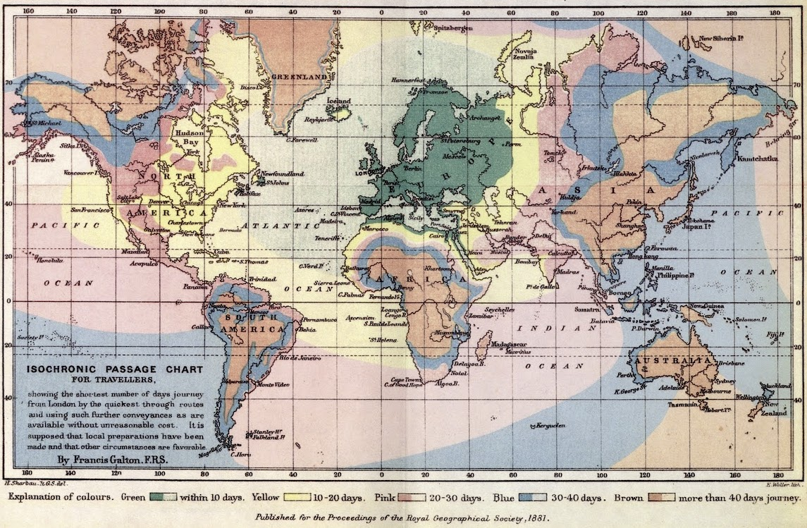
Isochrone maps are one of my favourite things. They show far you can travel from a place in a given amount of time. There are lots of classic examples, but this one by Francis Galton is the first-known. It shows travel times in 1881 to different parts of the world.
Now, if you're in certain European cities, you can make your own with a service developed by Iamsterdam and TravelTime. Head to mapitout.iamsterdam.com, put in your address in the top bar, pick an amount of time and a mode of transport, and you'll get a custom isochrone map.
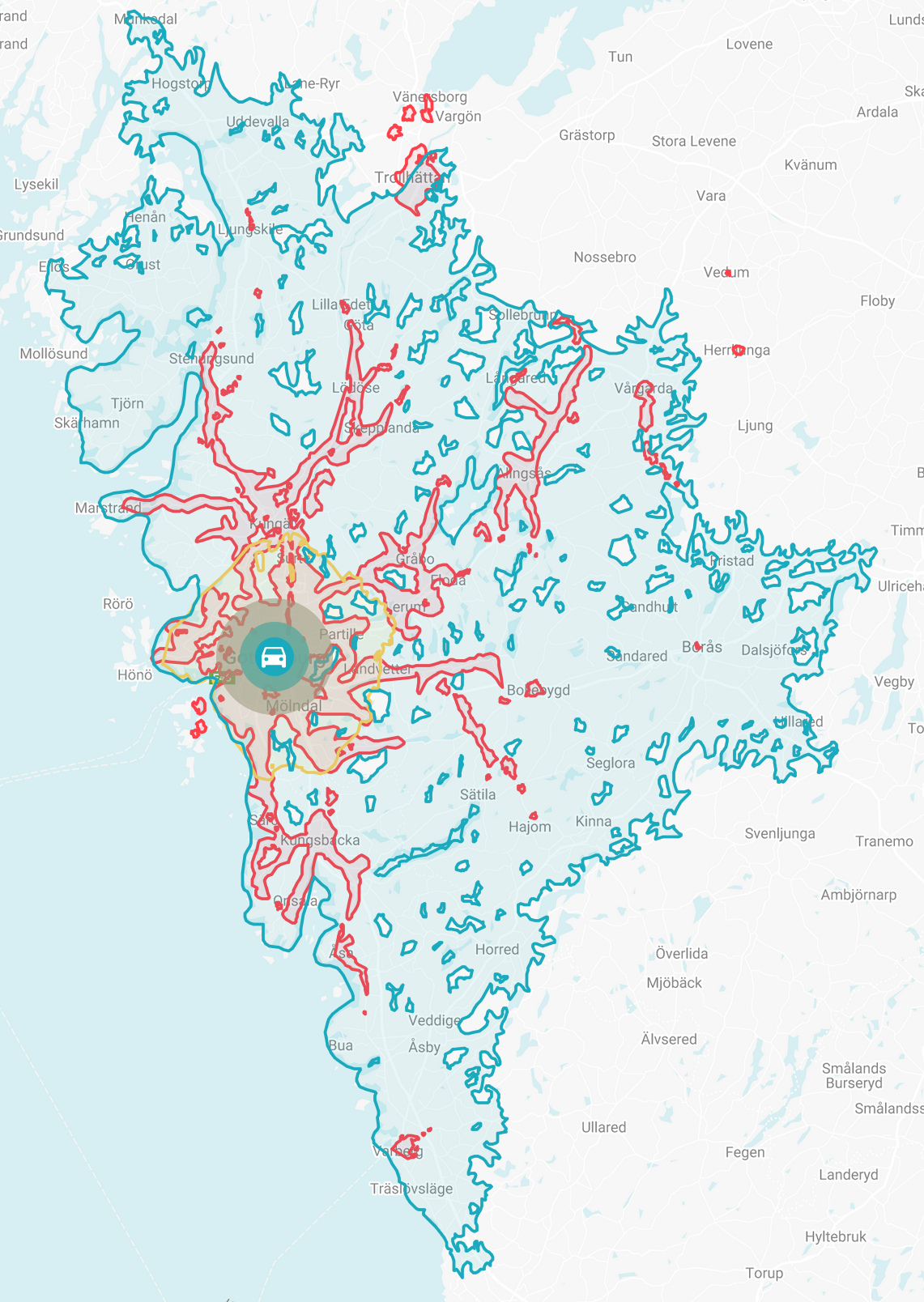
Here's one for Gothenburg, for example, showing 60 minutes of public transport (red), cycling (yellow) and driving (blue).

I love how organic the results are. They look like corals, or rock formations. Hmm... maybe that's an idea...